I had been planning this trip for about four months. The original goal was to finish photographing the lighthouses on the Michigan border of Lake Michigan. Seven remained, all along the southern edge of the Upper Peninsula.
Driving eight hours each way just to reach them did not sound like the best use of the trip. I decided to fly into Milwaukee instead and build a much larger route through Wisconsin and Michigan, with 45 lighthouses on the itinerary.
As July 18 approached, the weather weighed on me. It was very hot, and smoke from Canadian wildfires to the north had brought haze into the region. After months of preparation, I was extremely nervous that the fires might ruin the photography trip.
Off the plane and straight to the harbor
My flight from Detroit landed in Milwaukee at 8:52 a.m. After picking up an Avis rental car, I left the airport at about 10:00. The drive toward the pier was my first look at the city: from the airport side of Milwaukee toward its lakefront, with the harbor infrastructure, the Hoan Bridge, and the downtown skyline coming into view as I approached the water. I had spent months planning distant shoreline stops, and suddenly the first two lights were right there in the middle of a city.
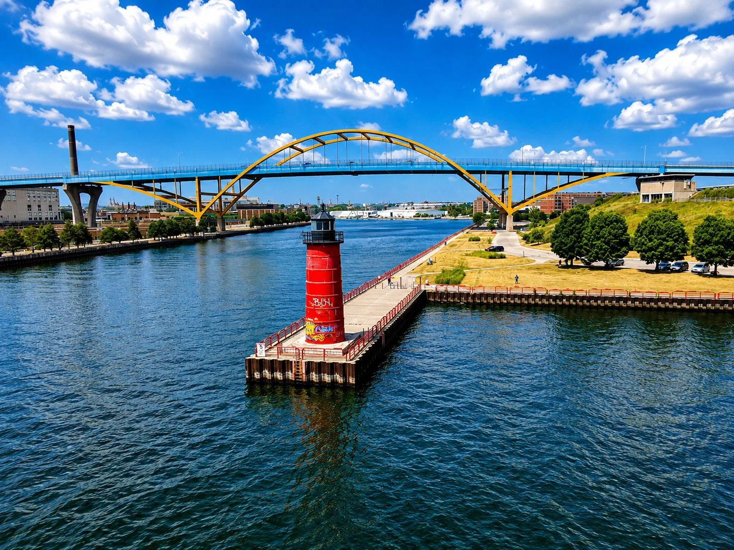
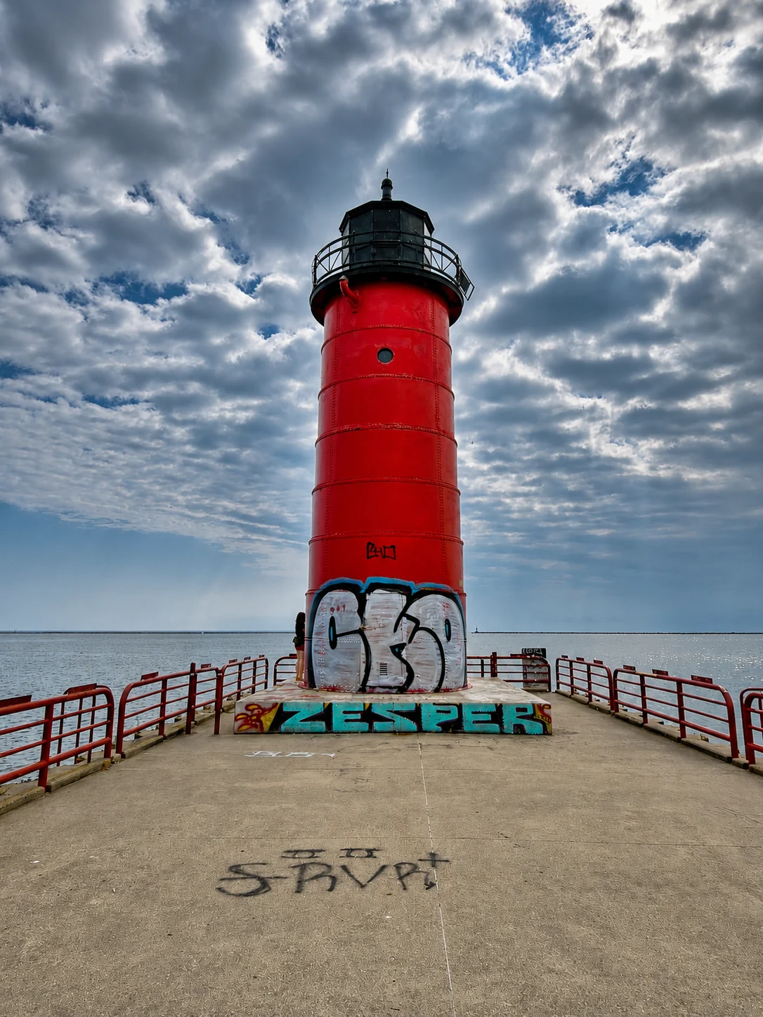
By 10:17, I was at Milwaukee Pierhead Lighthouse. Its red tower stands at the end of the pier, with Lake Michigan on one side and the harbor channel on the other. Milwaukee’s pierhead light station dates to 1872, while the present tower was first lit in 1906. That bright red shape makes an unmistakable foreground for the bridge, water, and skyline. The Coast Guard’s station record gives the dates.
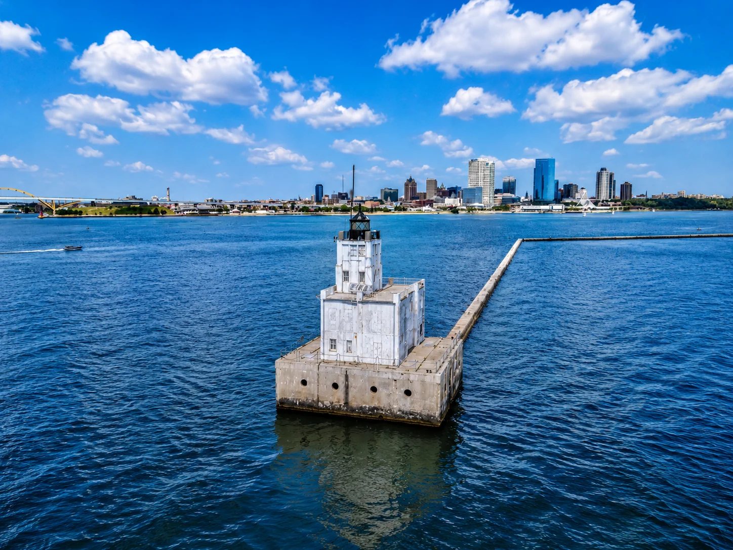
Milwaukee Breakwater Lighthouse was a very different photograph. It sits well out in the harbor, beyond the easy reach of a walk from shore. I used my drone to see it properly; the flight to the light was about 1.2 kilometers. From above, its white square tower and black lantern stood against the blue water, with the city stretching across the background. The breakwater had a light in the 1890s, and the present structure replaced it in 1926. The Coast Guard records that the lens from Pierhead was moved to the new Breakwater light, linking these two stops in more than just my itinerary. Read the Breakwater history.
Once I had views of the individual towers, I decided to widen the compositions and include Milwaukee itself. The Pierhead with the yellow Hoan Bridge behind it and the Breakwater with the skyline across the harbor gave the first stop a sense of place. Those city views turned out to be some of my favorite frames of the morning.
It was a quick opening session for a trip with a lot of ground to cover. The next lighthouse was already waiting on the north side of town.
July 18 at a glance
- 8:52 a.m.
- Arrived in Milwaukee from Detroit
- 10:00 a.m.
- Departed in the Avis rental car
- 10:17 a.m.
- Reached Milwaukee Pierhead
- After 10:17
- Photographed Pierhead and flew the drone roughly 1.2 km to view Breakwater
- 11:00 a.m.
- Arrived at North Point Lighthouse; spent about 15 minutes on the grounds
- 12:30 p.m.
- Arrived in Port Washington during the Fish Days parade
- 2:40–2:50 p.m.
- Stopped at Calumet Harbor Lighthouse in Columbia Park
- 3:00–3:10 p.m.
- Photographed Fisherman’s Road Lighthouse
- 3:15–3:40 p.m.
- Explored and photographed Fond du Lac Lighthouse
North Point, above the lake
From the harbor, I headed north toward Lake Park. The lakefront route follows Lincoln Memorial Drive before climbing from the water toward the bluff and Wahl Avenue. The shift was part of what made the short drive memorable: downtown and the working harbor gave way to older East Side streets, leafy blocks, and a neighborhood that felt almost like a college town. I arrived at North Point Lighthouse at 11:00 a.m.
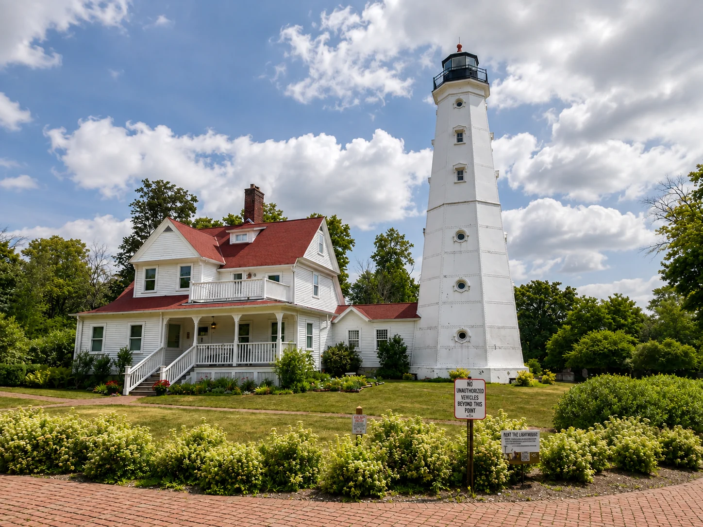
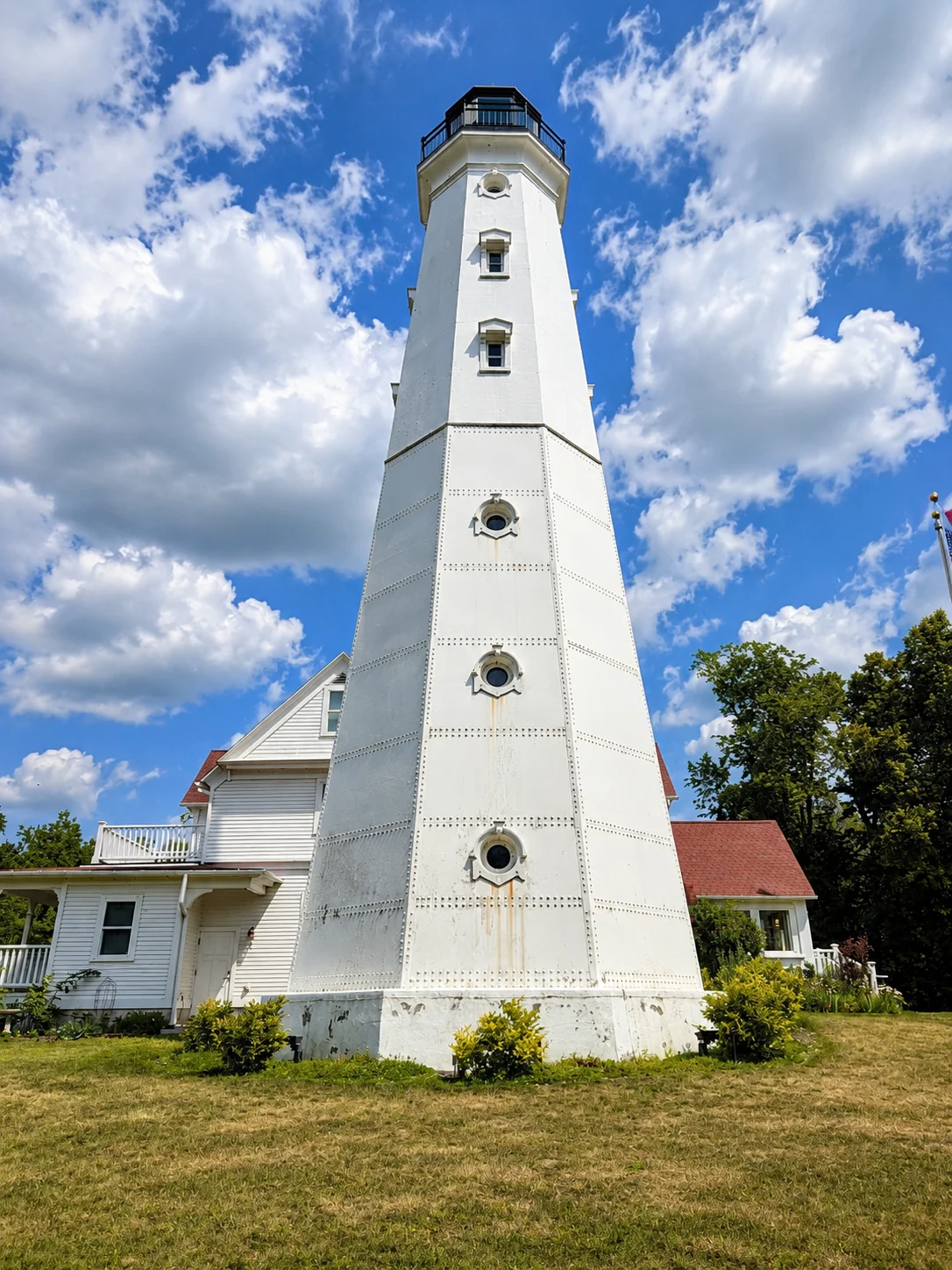
I spent only about 15 minutes there. The lighthouse was not open yet, so I could not tour the tower or keeper’s quarters. Even from outside, though, the white tower and red-roofed house made an impression. The grounds were lovely, and the setting above Lake Michigan gave me plenty to enjoy and photograph in a short stop.
A light with a long history
North Point has watched over Milwaukee’s lakefront since 1855, when its first Cream City brick lighthouse began operating on the bluff. Erosion later threatened that original site, so a new cast-iron tower and keeper’s quarters were built farther inland. The present light first shone in 1888. As Lake Park’s trees grew and city lights competed with the beacon, the tower was raised; by 1912 it stood 74 feet tall. North Point Lighthouse’s history tells that story in detail.
Lake Park itself was designed by Frederick Law Olmsted, and the light station sits between two ravines within it. The lighthouse served mariners until 1994 and was later restored as a museum. I missed the chance to climb the tower that morning, but the park setting and the building’s history made this much more than a quick box to check. Learn more from North Point Lighthouse and Museum.
Lunch, then a very different lighthouse
After North Point, I stopped at Culver’s in Mequon for a spicy chicken sandwich. I had given up fast food, but on a day built around tight stops and miles of driving, I made an exception. Then I kept heading north toward Grafton. The route moved away from Milwaukee’s busier lakefront into quieter suburban streets and, near the light, the more wooded, residential feel of Lake Shore Road. It was a change of pace from the three public-facing Milwaukee stops.
Kevich Lighthouse was the one I was least sure how to photograph. It is part of a private home, set back on a lot rather than at the end of a public pier or in a park. I drove past two or three times, trying to judge whether I could get a clear view without disturbing anyone. In the end, I pulled up in front of the driveway, stayed mindful of the property, took four quick photos, and moved on.
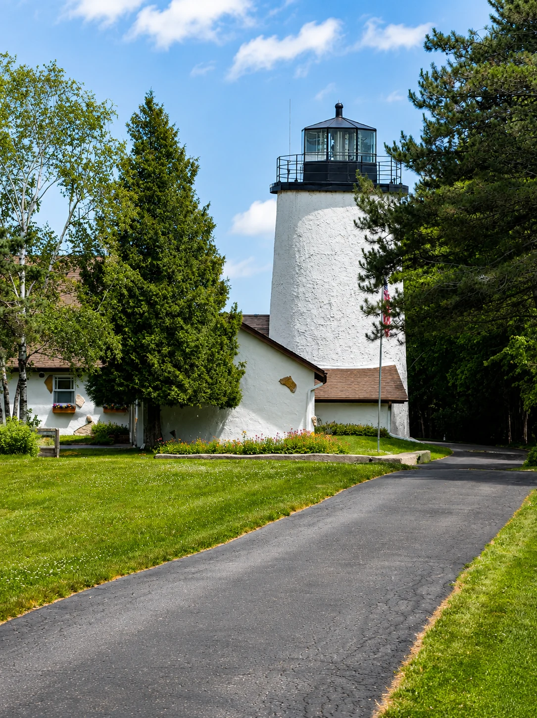
The light is unusual because it began as someone’s dream of living in a lighthouse. Brana and Neva Kevich built the lighthouse home in 1981 on a bluff overlooking Lake Michigan. The white tower is attached to the house and rises about 50 feet, but its position high above the shoreline puts the light’s focal plane roughly 163 feet above the water. In 1990, the Coast Guard certified it as a private aid to navigation. It is a real working beacon with the intimacy of a family home, which is what makes it so different from the harbor lights I had photographed earlier. The grounds and dwelling are private and closed to visitors. Kevich Lighthouse history and visitor information.
Port Washington, with a parade in the way
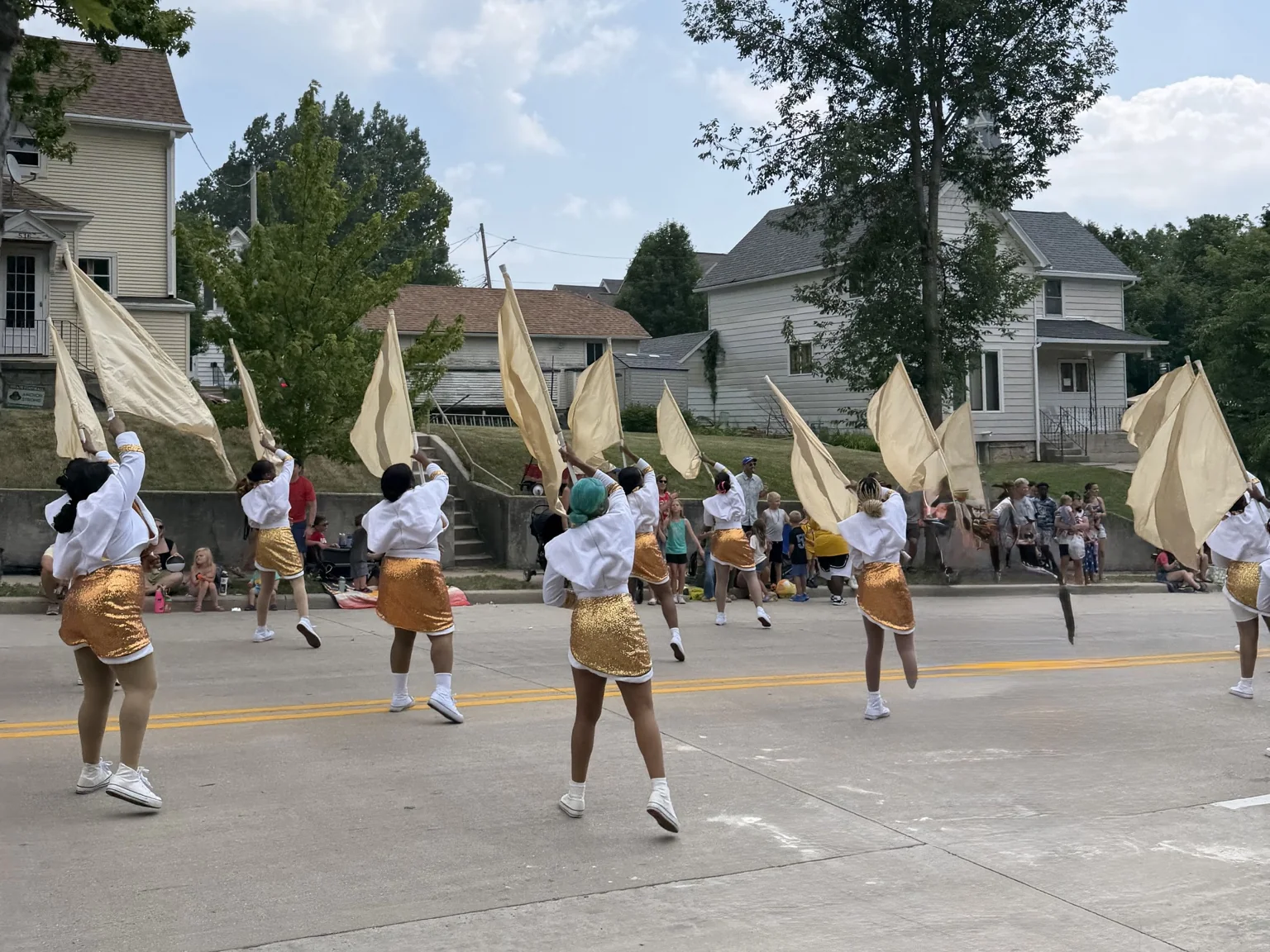
From Kevich, I continued north toward Port Washington, staying close to the Lake Michigan side of Ozaukee County. The quieter roads around Grafton gave way to the small harbor city, but getting to the lighthouses was not as simple as following the route on my phone. I arrived around 12:30 p.m., right in the middle of Port Fish Days. The parade had streets rerouted, so I found parking at a church and set out on foot.
It was a good day to be walking. The weather was beautiful, the town felt lively, and the festival gave the stop a very different energy from the quick roadside visit at Kevich. I watched part of the parade as I made my way through town, then walked about ten minutes, roughly a quarter mile, to the Port Washington 1860 Light Station.
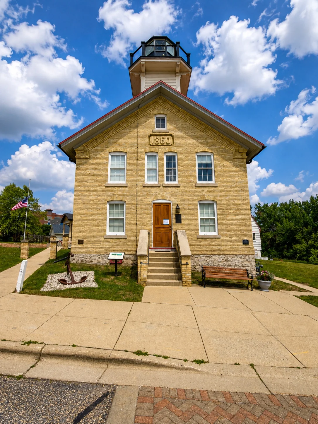
The historic station sits on the north bluff overlooking downtown and the lake. A light first stood here in 1849; the brick station I photographed was rebuilt in 1860 with the lantern room above the keeper’s living quarters. Today it is preserved as a museum by the Port Washington Historical Society. The building itself tells a different chapter of the harbor’s story from the modern breakwater light below. History of the 1860 Light Station.
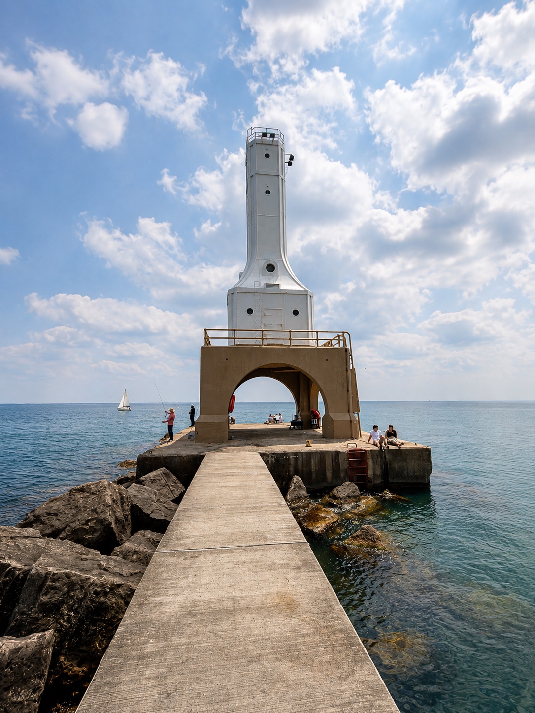
From there, I went down a lot of steps toward the waterfront. The harbor was full of boats, and the walk out along the pier gave me more time to take in the city and the lake. It took another ten minutes or so, about half a mile, to reach Port Washington Breakwater Lighthouse. I was happy for the exercise after the morning in the car.
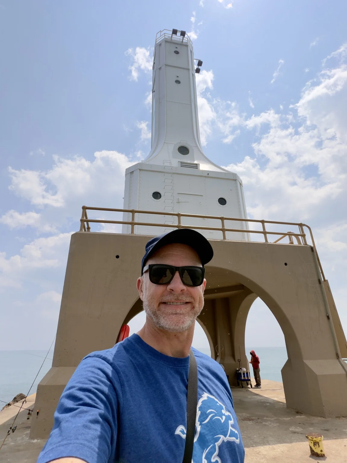
The breakwater light is the sharp-edged Art Deco counterpart to the older station on the bluff. Built in 1935 at the end of the north breakwater, it stands over the harbor entrance with Lake Michigan on both sides of the long walk. The approach is part of the experience: the lighthouse grows larger step by step until its arch and tower fill the view. Wisconsin’s lighthouse overview.
Inland to Calumet Harbor
After Port Washington, I turned away from Lake Michigan and headed inland toward Lake Winnebago. The harbor streets and open lakefront gradually gave way to smaller towns, rolling farmland, and a different kind of shoreline. Lake Winnebago is linked northward to Green Bay and Lake Michigan by the Fox River, so this detour still felt connected to the larger waterway I had been following. The Army Corps describes that connection.
I reached Calumet Harbor Lighthouse at 2:40 p.m. in Columbia Park, a Fond du Lac County park on Lake Winnebago’s eastern shore. Unlike the enclosed towers I had seen earlier, this one is a tall, open framework of rust-red steel with white zigzagging stairs and platforms. It serves as an observation tower and navigation beacon at the harbor entrance. The county describes it as a 70-foot tower, and its unusual design makes sense once you learn that it began as a water tower, was moved here in 1936, and was restored for climbing in 1992. Columbia Park details · Tower history.
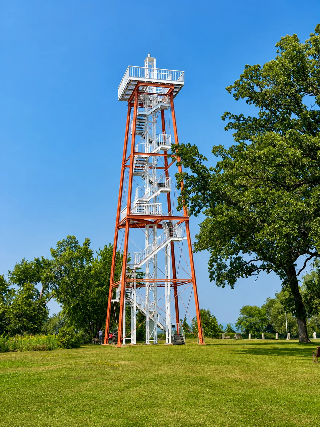

I climbed about three quarters of the way up. I’m not going to lie: with the wind blowing through that open structure, it was a little nerve-racking, and I decided not to go all the way to the top. Partway up, a military helicopter flew by, which made the short visit even more memorable. By 2:50 p.m., I was back on the road. Ten minutes was enough to know this was one of the most unusual lights of the day.
A quick stop at Fisherman’s Road
It was a short drive south along Lake Winnebago’s eastern shore to Fisherman’s Road Lighthouse. I arrived at 3:00 p.m. and stayed about ten minutes. After Calumet’s tall climbable tower, this was a much smaller, simpler light: a white, hourglass-shaped steel beacon at the end of a short concrete pier, with the lake stretching behind it. There was not much to shoot from different angles, so I took my photos and kept moving.
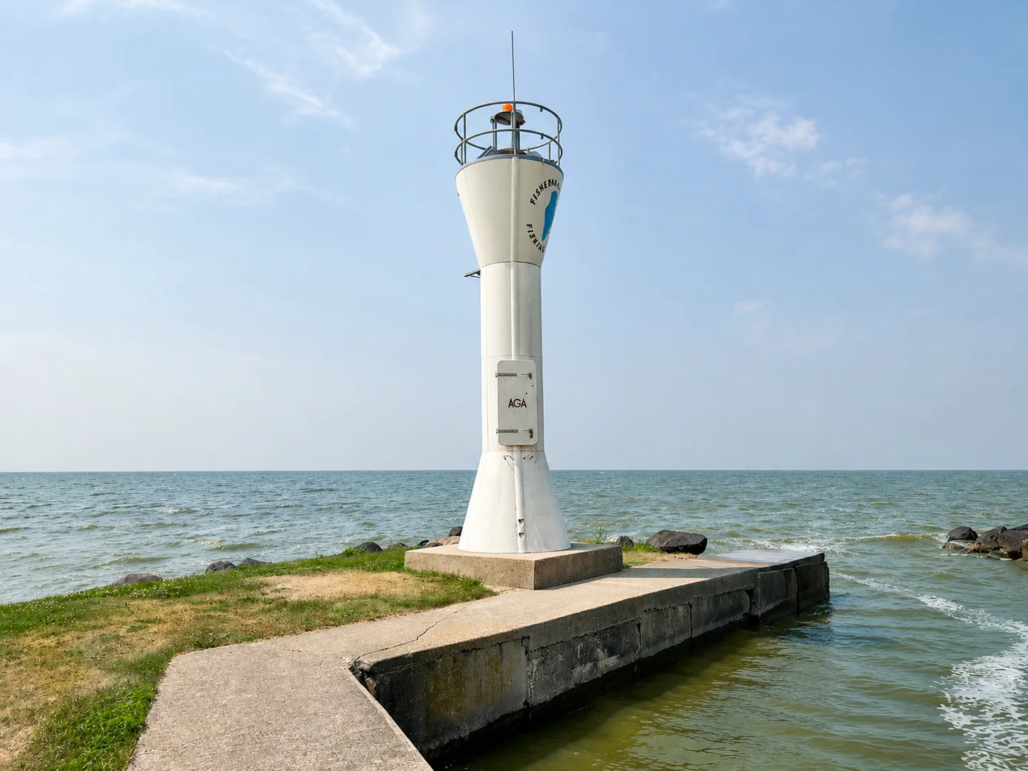
Its job is practical. The light marks the entrance to the boat ramp and small marina used by the Fisherman’s Road Fishing Club, helping boaters find the landing from the lake. The little tower once stood beside the larger Calumet Harbor light I had just visited; it was moved here around 2001. Seeing them back-to-back gave this brief stop a connection I would not have guessed from their very different shapes. Fisherman’s Road light history.
Inside the Fond du Lac light
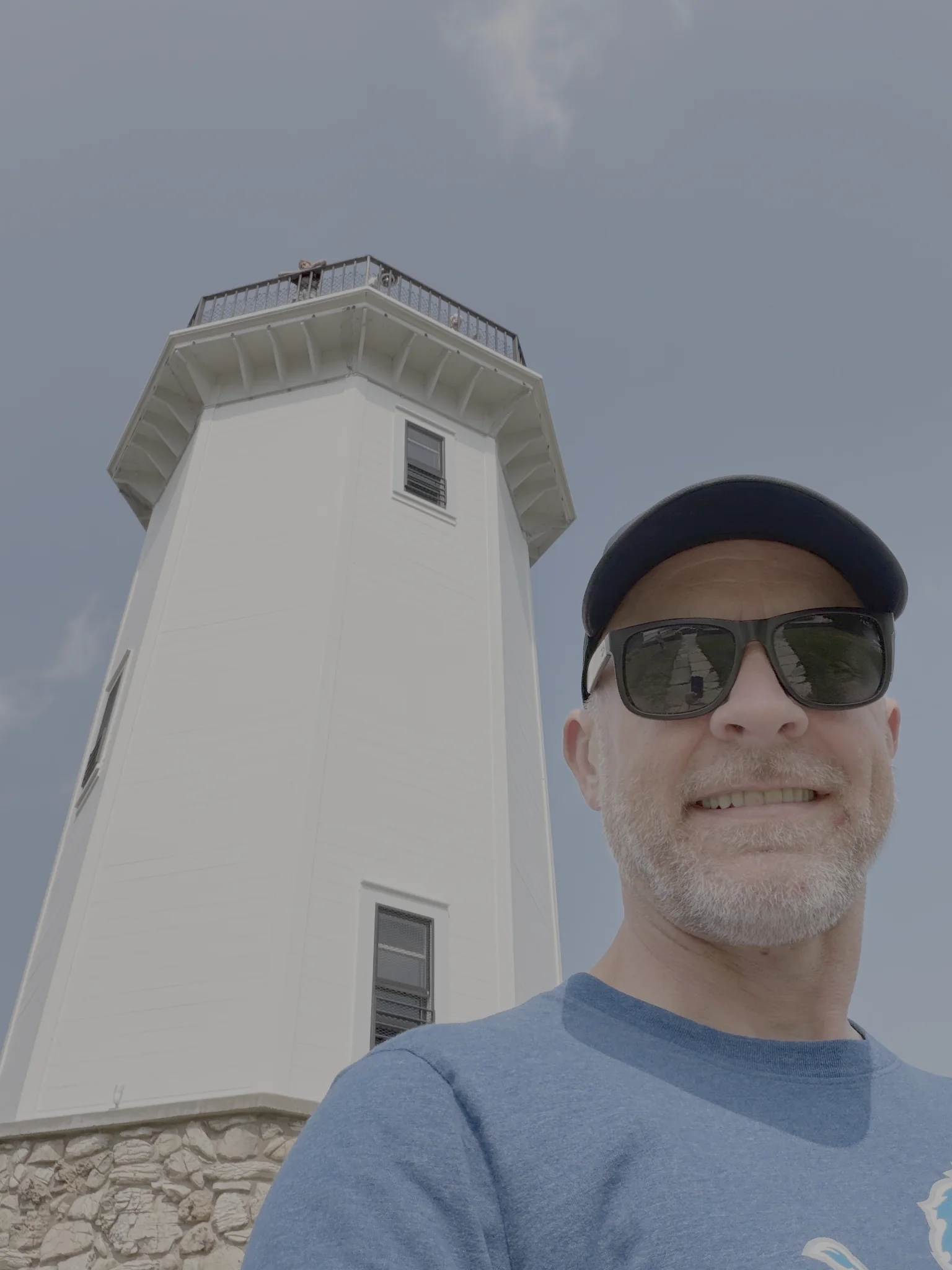
My next stop took me to Fond du Lac at the south end of Lake Winnebago. I reached Lakeside Park at about 3:15 p.m., parked right on Lighthouse Drive, and had only a two-minute walk to the light. After the brief stop at Fisherman’s Road, I gave this one more time. The door was open, so I could step inside and climb the tower rather than photograph it only from the shore.
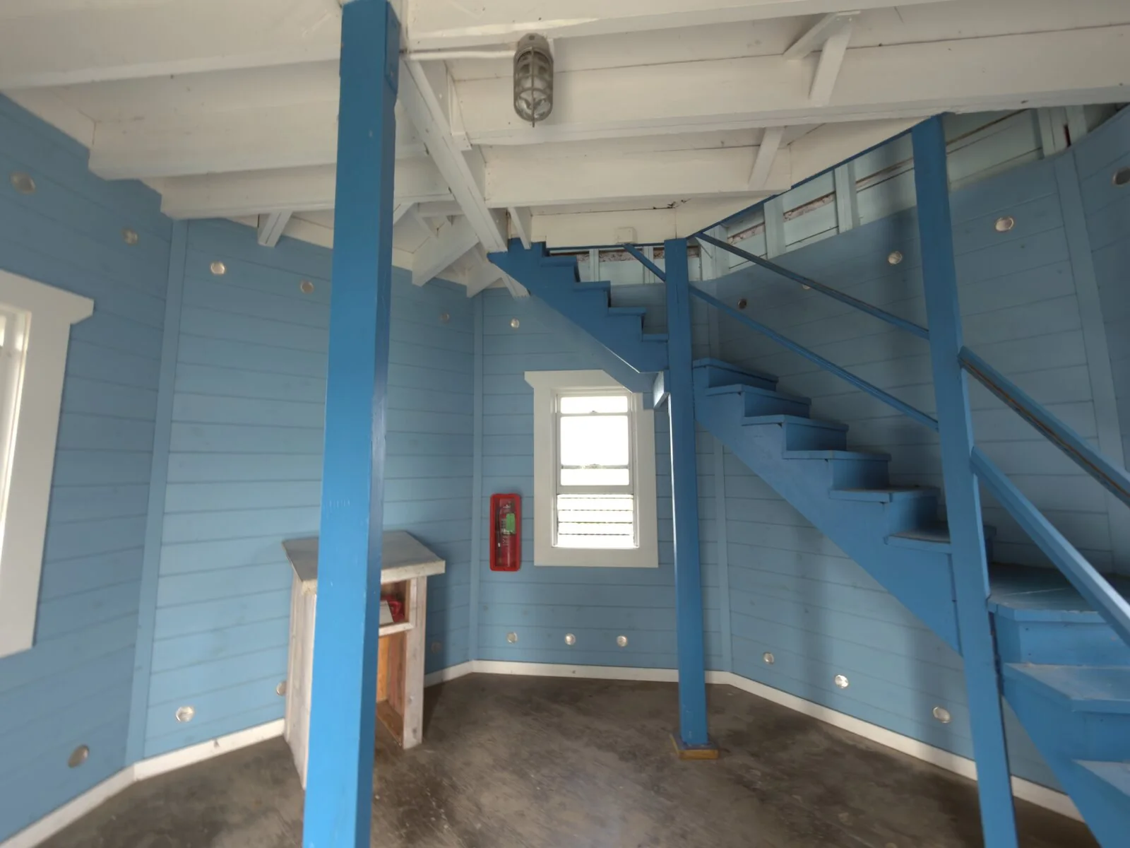
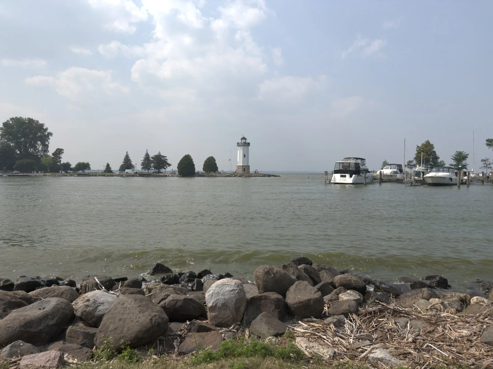
Fond du Lac Lighthouse stands at the entrance to Lighthouse Harbor, where boats come in from Lake Winnebago. The white, eight-sided tower rises above a fieldstone base, with a dark lantern and observation railing at the top. Built in 1933, it remains a working light and a landmark of Lakeside Park. Its interior wooden stairs lead to a view over the harbor, the park, and the lake. Wisconsin’s lighthouse description.
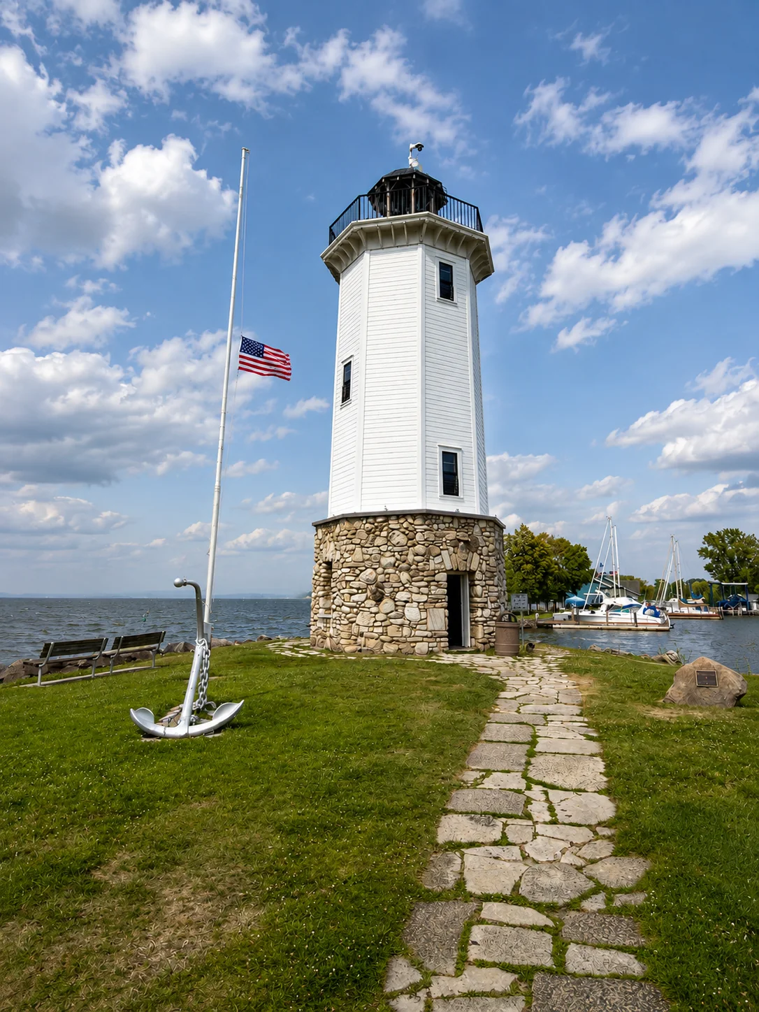
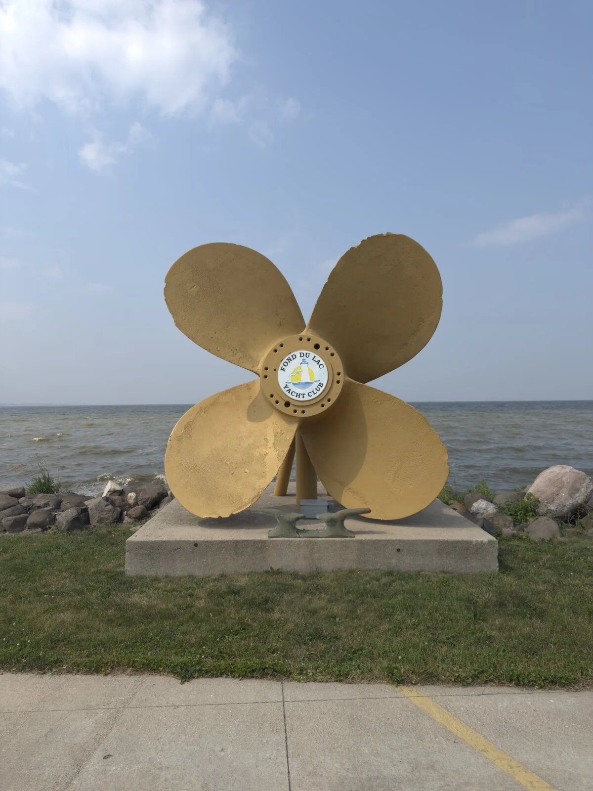
I photographed the lighthouse from several angles, then went inside for a look at the blue-painted stairs and the view from above. I also took a shot across Lighthouse Harbor, where the tower appeared smaller against the boats and shoreline. Those wider views gave the light a setting, while the interior made this stop feel more like a visit than a quick photograph.
My last photo there was at 3:40 p.m. I had managed a short tour and a few distinct perspectives before getting back on the road.
Bray’s Point: a plan changed by the sky
The drive from Fond du Lac to Oshkosh was one of the longer stretches of the day, about 32 minutes. I headed north from the south end of Lake Winnebago, following the west side of the lake before turning through Oshkosh toward the Fox River’s entrance. The open stretches of road gave way to neighborhood streets near the water. By about 4:08 p.m., I was in the area of Bray’s Point Lighthouse.
I had been skeptical about photographing this one. The lighthouse is on private property, and the grounds are closed. My plan was to find a nearby public spot along the shore and use my drone for a view without disturbing the owners. I drove past the address, found a park, and got ready to launch—then discovered the drone flight restriction on my app. EAA AirVenture Oshkosh was due to begin on July 20, but the FAA’s special flight procedures had already taken effect on July 16. My drone app marked the area off-limits, so I left the drone grounded. FAA AirVenture 2026 notice.
After a few more passes, I saw an opening from the public street through the driveway. I stopped briefly, stayed off the property, and took a couple of quick photos. It was a compromise, but the tower came through clearly: a slender eight-sided form with pale green panels and white trim, a little railing around the top, and an open green lantern capped by a pointed spire. It is not a large lighthouse, but the detail makes it one of the most distinctive designs I saw all day.
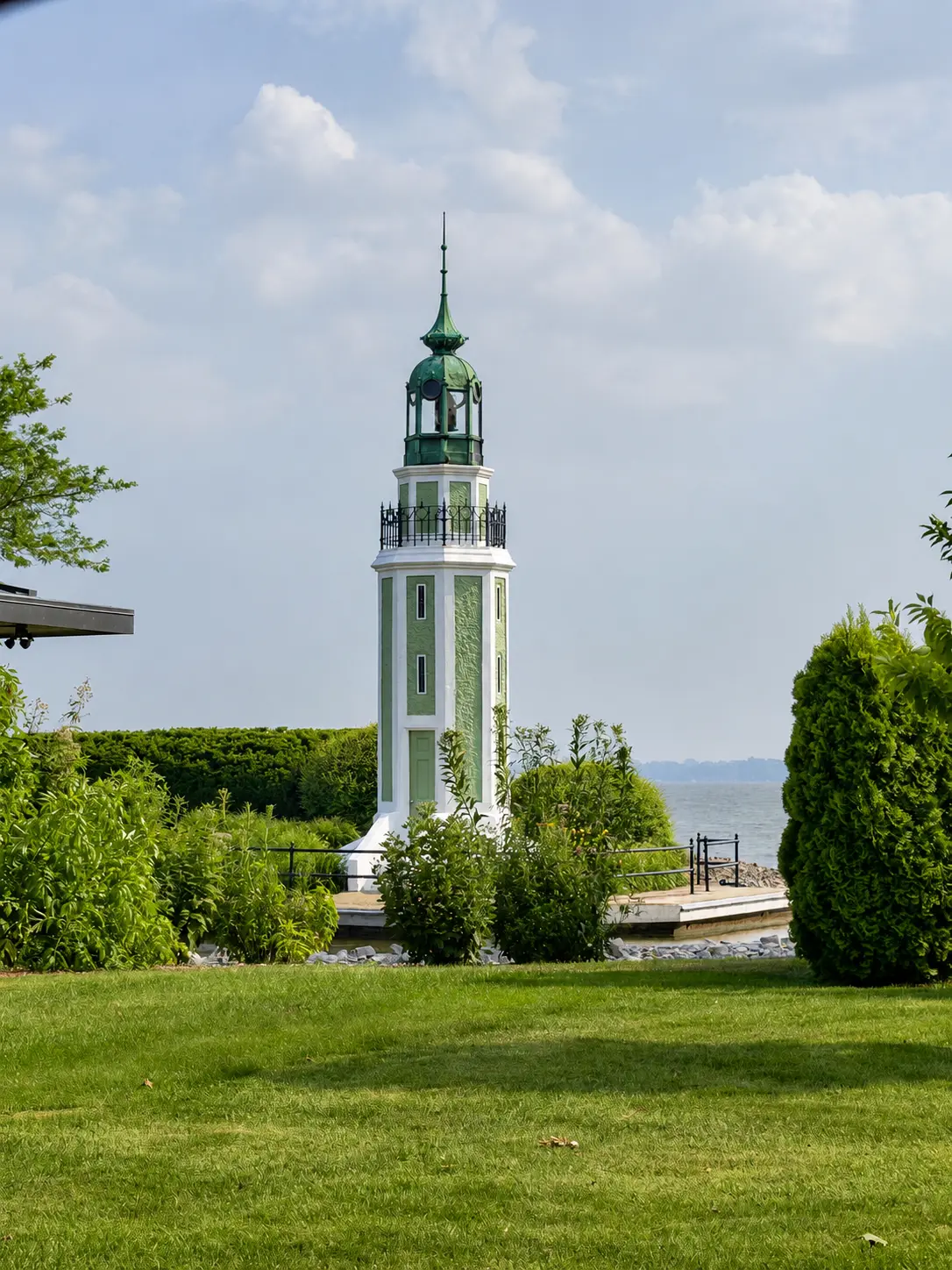
William Bray had it built in 1910 to mark both his private harbor and the entrance to the Fox River from Lake Winnebago. Oshkosh architect George A. Rockwell designed it, which is why the light is also known as Rockwell Lighthouse. It once displayed a steady red light and appeared in official Light Lists for decades. Today it remains a privately owned landmark rather than a public attraction; the grounds and tower are closed, and it no longer appears on the Coast Guard’s official Light List. Bray’s Point history and visitor information.
Between the failed drone plan and the quick street-side shots, I was done by about 4:30 p.m. I left with the photograph I had hoped for, even if it came from a very different angle than the one I had planned.
The Wisconsin and Upper Peninsula route continues from here. I’ll add the next stop as the trip story unfolds.